|
I awoke in my hotel in Centralia, Washington State. While the room was very nice, I was still not used to the time change, and tossed and turned for the last hour. I do hope my body figures this out soon!
I set up the V-phone for Ronald, and he talked to his folks and his girlfriend while I took a shower. When I bought the V-phone, I didn’t think that the evenings would be no good for calling back home. Everyone is already asleep by the time we stop for the night. And in the mornings, I’m usually in a hurry to get on the road. Oh well, this journal will fill in in some regards.
We had a lovely breakfast of bagels and cereal in the little lunch room at the hotel. I do like these complementary breakfasts. I was a bit slow getting moving this morning, and so we didn’t get on the road until about 8:30.
The GPS led us flawlessly through the back roads and up the mountains right to the top of Mount St. Helens. I had reset the GPS the previous night to send us to the Johnson station, rather than the southern outlook. The gentleman in the hotel had told us what the best site would be. It took us about an hour to get to the summit.
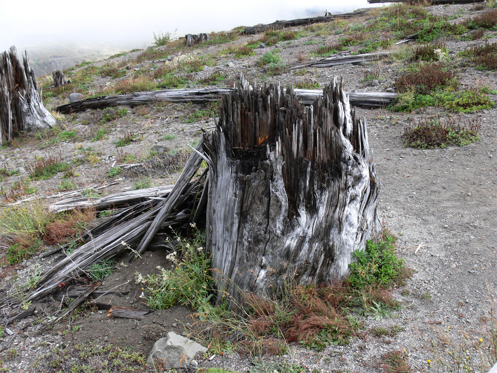
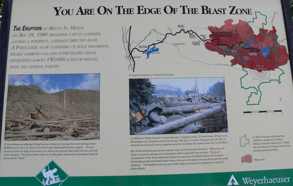
About 20 minutes away from our destination, we started seeing the denuded hills with only stumps remaining, and a lot of timber lying around. We stopped at the little viewpoint along the way by a bridge, and were told that this was the edge of the blast area.
The closest thing I can compare it to is what I’ve heard a nuclear blast looks like. Apparently, hot winds and flying stones traveling at over 700 miles an hour ripped through the area, and flattened 250 square miles’ worth of timber. It was called the stone wind. The local forestry company was able to
go in and recover a good portion of the felled trees before they started to rot.
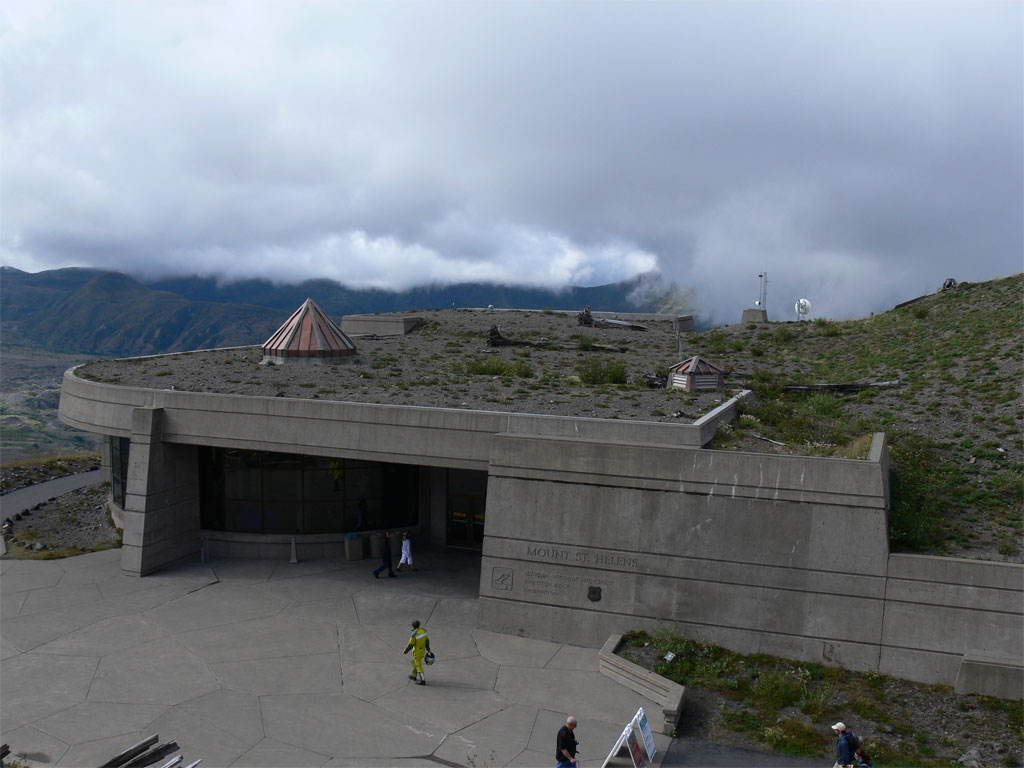
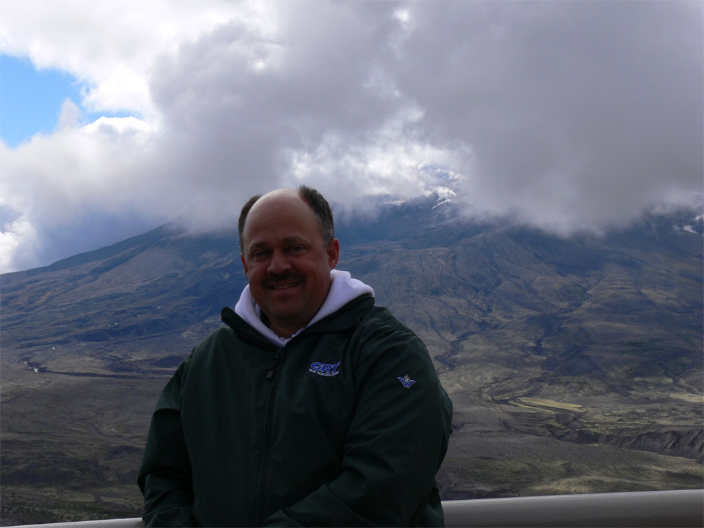
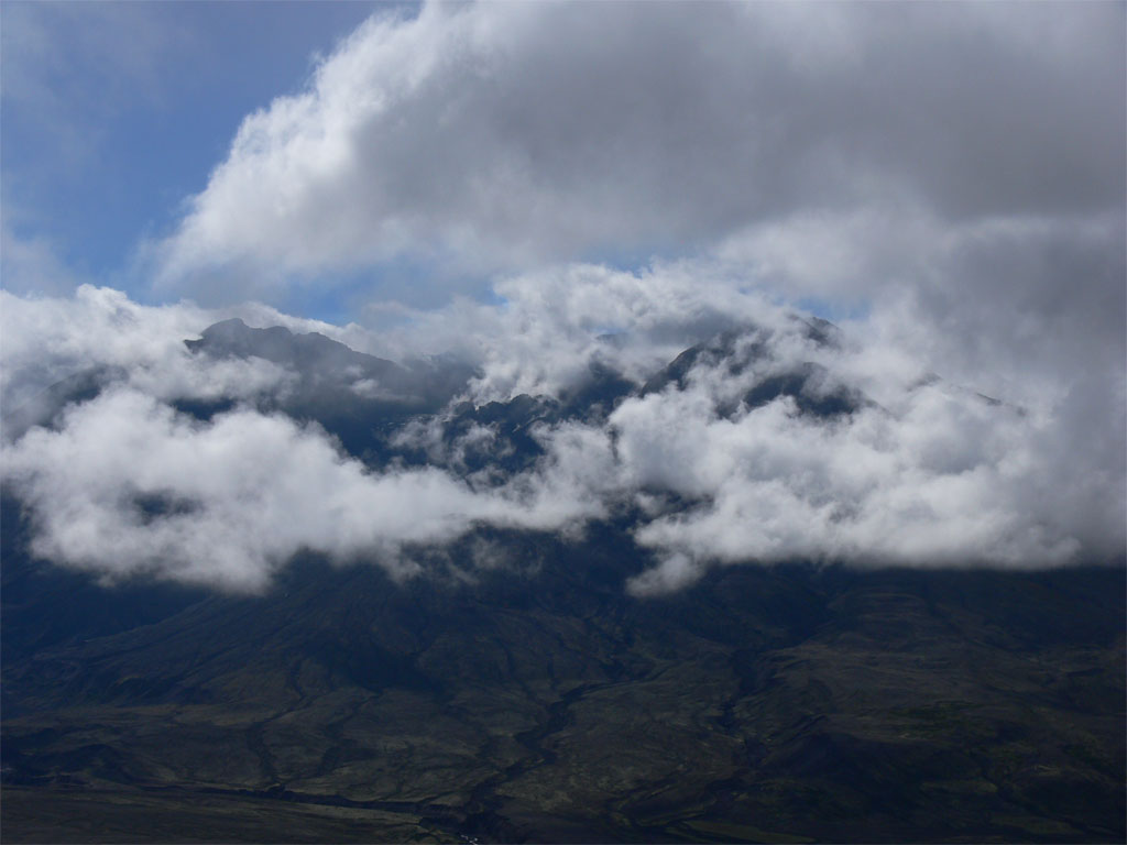
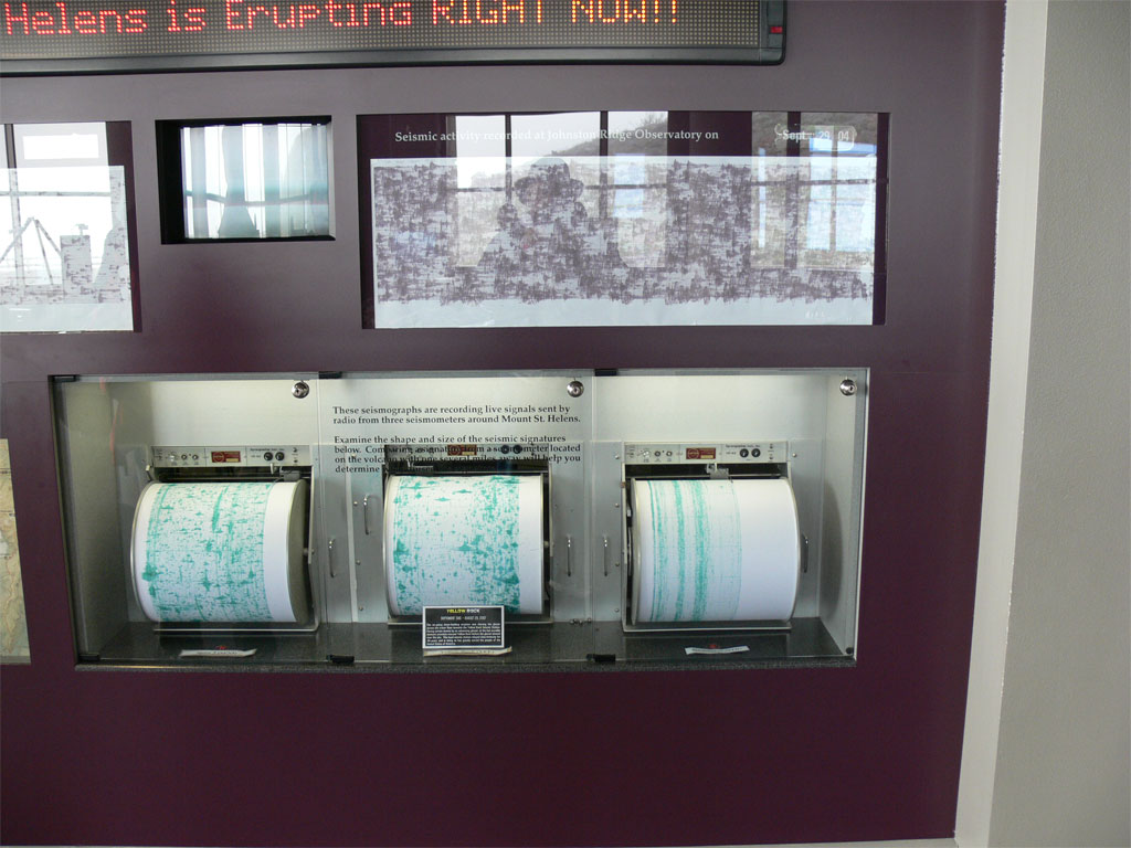
When we reached the summit, we were able to use our Parks Pass, rather than have to pay the entry fee. The view was somewhat obscured by clouds. We had been going in and out of the clouds all the way up the mountain. In fact, I’d describe this area as somewhat of a rain forest. Everything was green, and it rained off and on all the way up. A couple we met at the viewpoint said that it had been fogged in for the last four days. Fortunately, it partially cleared while we were there. We were able to get some halfway decent shots. However, the very top of the rim remained obscured in clouds.
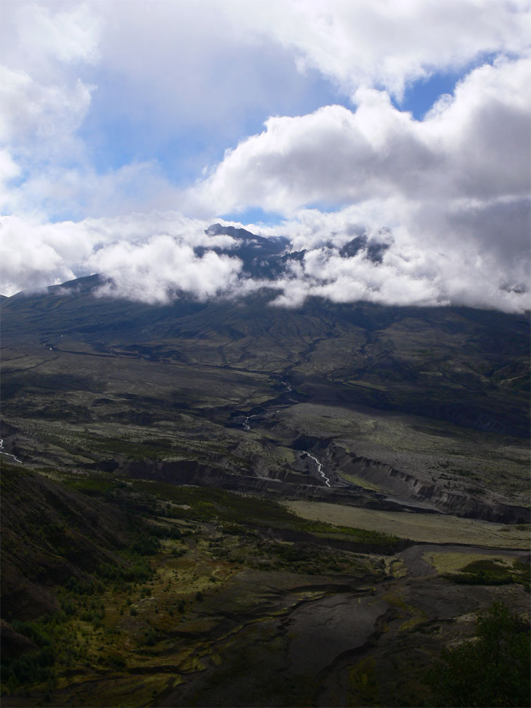
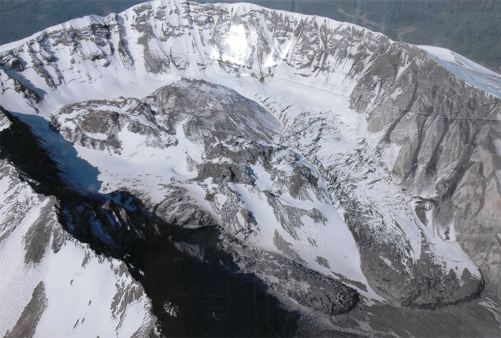
What Ronald and I both came away with was the impression of the immense power of this blast. Apparently the event started with the largest landslide in recorded history. The entire 1300-foot top of the mountain suddenly collapsed and flowed down into the valley beside it towards the peak we were standing on, which was seven miles away. It flowed
like water straight up our peak, over the top, and over the peak behind us. The majority of the debris, however did not go over the top of Johnson Peak, but diverted westward towards a river valley. It ended up depositing 200 feet of mountain debris through the valley and the surrounding area.
Seconds after the landslide, the tremendous blast occurred which levelled full-grown Douglas fir trees up to 14 miles distant. We took several shots of huge trees that were about 4 feet in diameter, lying felled and half buried under debris. As far as the eye could see, there was nothing but stumps and rotten logs. Apparently, a world renowned geologist named Johnson was standing on this ridge trying to collect data about what would happen immediately prior to a volcanic eruption. He was apparently vaporized where he stood!
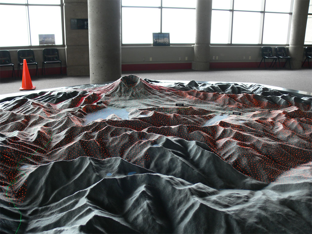
The inside of the exhibit had a large topographical map with tiny lights that demonstrated in a visual format this series of events that took place back in 1980. After the landslide and the stone wind, a torrent of volcanic rock poured out of the crater and covered the landslide material with up to 100 feet of pumice rock. He had a sample there with them, and it was extremely light. The entire blast area in front of the volcano was covered by the landslide debris, and the pumice layer on top. The average height was 200 feet, with some spots being six hundred feet deep.
A few hours later, all the water that had previously been on top of this snow-covered volcano started a huge
landslide down the river valley with the material from the first landslide. It roared some 14 miles down this river valley, and killed numerous people. There was a plaque honouring the deceased.
Finally, the volcano continued to spew ash high into the altitude, which eventually circled the entire planet. However, the majority of the energy went out sideways in a lateral blast, which accounts for the extensive devastation in the area.
The whole scene left you in awe of the power of this explosion. They describe, through various exhibits, how they’ve been able to figure out what happened in other volcanoes which were not witnessed. Volcanoes in Russia, Mexico, and other locations could now be figured out. One of the interesting features was that the landslide included intact chunks of debris from the side of the mountain which were rolled along with the rest of the semi-liquid material, but would abruptly come to
a stop in various locations. These were called, hummocks. They look like small hills scattered randomly around the valley.
We walked up the tiny trail to the top of the ridge beside the exhibits, and looked at the surrounding countryside. Even 27 years later, most of it looks completely denuded. However, you can spot the odd small Christmas-tree size conifers. Apparently, these very small trees were buried under snow on the forest floor when the explosion occurred, and were able to spring back to life in short order. Also, many of the insects and rodents were still hibernating underneath the ground, and they also survived the blast.
We also attended a Rangers talk on the viewing platform, which was very informative. I always try not to miss the Ranges talks, as actually speaking to the person rather than reading plaques can be much more informative. I’ve also gotten into the habit of
taking close-up pictures of all the information plaques so that they can be read at home later on.
On the way out, we stopped in at a hot dog stand for lunch. Just as we were finishing our hot dog, it started to rain, so we made a mad dash for the car, and headed out.
We stopped a few miles down the road at the Coldwater Lake Exhibit. The interesting thing about this exhibit was the fact that Coldwater Lake did not exist prior to the explosion. The landslide dammed up a small creek and created this rather large lake. It is 200 feet deep.
The Ranger informed us that this entire facility, which looks to be fairly new, is to be closed in November due to insufficient funding. It seems the legislators are cutting park budgets. This particular exhibit was dedicated to the biology aspect of the recovery of this blast zone. He went into great detail about how they had tracked coyotes after the
blast. Apparently they adapted to the open forest canopy, and tripled in numbers.
I have to say, though, that coyote recovery is not nearly as interesting as viewing the crater from the Johnson Ridge. I think this facility will indeed be closed.
After we had grabbed another snack, we hit the road. On our way through the mountains, we blew a fuse in the inverter, and pulled over to a gas station to buy a new fuse. We promptly blew yet another one, and had to replace it again. We reached I-5 South, and headed toward Portland.
As I tend to drive in the afternoon, I am dictating this, using my microphone, as I am driving down the highway. So far, this type of journaling is working quite well. My computer will not accept the voice recognition program that I already have, called Dragon Naturally Speaking, but the Microsoft Voice To Text Program is working adequately. I
certainly would not be able to type all of this! However the Microsoft voice recognition makes more mistakes than my other program, and I have to go back and edit it later on.
We stopped a bit early today in order to get the laundry done. We found a nice Super Eight Motel in Eugene, Oregon. It was the perfect location, with a lovely Chinese buffet restaurant almost across the road. After supper, we got the laundry done, and I published yet another travel day on the Internet. I find the editing of photos being the most time consuming part of this exercise. However, I'm getting good feedback.
We traveled 467 kilometres today. Tomorrow we start heading for San Francisco!
|